


Page 112 - รายงานประจำปี สำนักการวางผังและพัฒนาเมืองปี 2568
P. 112
3     จุดิเส่�ยุงภััยุในชื่่วิติแล่ะที่รัพิ่ยุ์สิน
                    Life and Property Safety Risk Areas


                    แสดงพั่�นท่� 7 ล้ักัษณ์ะควิามเส่�ยงอันต้รุาย ครุอบคลุ้มจัุดม่ด-เปีล้่�ยวิ
                    พั่�นท่�รุกัรุ้าง  โครุงสรุ้างช้ำารุุด  แหล้่งมั�วิสุม  พั่�นท่�เส่�ยงอาช้ญากัรุรุม
                    พั่�นท่�หนาแน่น แล้ะจัุดท่�กัำาล้ังดำาเนินกัารุแกั้ไขัต้่อกัารุเกัิดอุบัต้ิเหตุ้

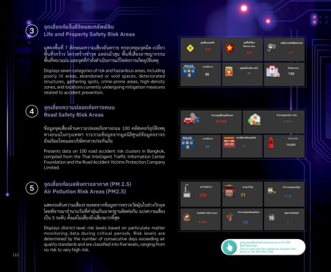
                    Displays seven categories of risk and hazardous areas, including
                    poorly  lit  areas,  abandoned  or  void  spaces,  deteriorated
                    structures, gathering spots, crime-prone areas, high-density
                    zones, and locations currently undergoing mitigation measures
                    related to accident prevention.


              4     จุดิเส่�ยุงความิปล่อดิภััยุที่างถนน
                    Road Safety Risk Areas


                    ขั้อม่ล้จัุดเส่�ยงด้านควิามปีล้อดภัยทางถ่นน 100 คล้ัสเต้อรุ์อุบัต้ิเหตุ้
                    ทางถ่นนในกัรุุงเทพัฯ  รุวิบรุวิมขั้อม่ล้จัากัม่ล้นิธิิศ่นย์ขั้อม่ล้จัรุาจัรุ
                    อัจัฉรุิยะไทยแล้ะบรุิษัทกัล้างปีรุะกัันภัย

                    Presents data on 100 road accident risk clusters in Bangkok,
                    compiled from the Thai Intelligent Traffic Information Center
                    Foundation and the Road Accident Victims Protection Company
                    Limited.


              5     จุดิเส่�ยุงภััยุมิล่พิ่ิษที่างอากาศ (PM 2.5)
                    Air Pollution Risk Areas (PM2.5)


                    แสดงรุะดับควิามเส่�ยงรุายเขัต้จัากัขั้อม่ล้กัารุต้รุวิจัวิัดฝุ่่นในช้่วิงวิิกัฤต้
                    โดยพัิจัารุณ์าจัำานวินวิันท่�ค่าฝุ่่นเกัินมาต้รุฐานต้ิดต้่อกััน แบ่งควิามเส่�ยง
                    เปี็น 5 รุะดับ ต้ั�งแต้่ไม่เส่�ยงถ่ึงเส่�ยงมากัท่�สุด

                    Displays district-level risk levels based on particulate matter
                    monitoring  data  during  critical  periods.  Risk  levels  are
                    determined by the number of consecutive days exceeding air
                                                                                                          ดูขุ้อมิูลจัุดเส่�ยงภััยสำาหรับป้ระชาชน 5 ด้าน ได้ท่�
                    quality standards and are classified into five levels, ranging from                   BKK Risk Map
                    no risk to very high risk.                                                            Click to view the five categories of public risk
                                                                                                          areas on the BKK Risk Map.
      112

