


Page 113 - รายงานประจำปี สำนักการวางผังและพัฒนาเมืองปี 2568
P. 113
การขุยายแผนท่�เส่�ยงภััย ระยะท่� 2 ในป้ีงบป้ระมิาณ พั.ศ. 2568

                Expansion of Risk Mapping: Phase 2 (Fiscal Year 2025)


                ในปีีงบปีรุะมาณ์ พั.ศ. 2568 ได้พััฒนา BKK Risk Map รุะยะท่� 2   In fiscal year 2025, the BKK Risk Map Phase 2 was developed by
                โดยเพัิ�มแผนท่�เส่�ยงภัยสำาหรุับปีรุะช้าช้นอ่กั 4 ด้าน เพั่�อต้อบโจัทย์  by adding four additional public risk maps to address emerging
                ภัยรุ่ปีแบบใหม่แล้ะควิามเส่�ยงเช้ิงโครุงสรุ้างขัองเม่อง      threats and urban structural risks.


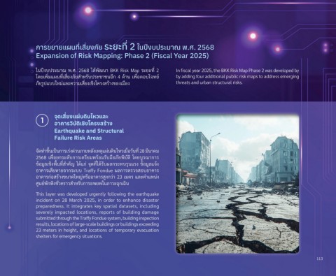
                  1     จุดิเส่�ยุงแผ่นดิินไหวแล่ะ
                        อาคารวิบูัติิเชื่ิงโครงสร้าง
                        Earthquake and Structural
                        Failure Risk Areas


                จััดทำาขัึ�นเปี็นกัารุเรุ่งด่วินภายหล้ังเหตุ้แผ่นดินไหวิเม่�อวิันท่� 28 ม่นาคม
                2568  เพั่�อยกัรุะดับกัารุเต้รุ่ยมพัรุ้อมรุับม่อภัยพัิบัต้ิ  โดยบ่รุณ์ากัารุ
                ขั้อม่ล้เช้ิงพั่�นท่�สำาคัญ ได้แกั่ จัุดท่�ได้รุับผล้กัรุะทบรุุนแรุง ขั้อม่ล้แจั้ง
                อาคารุเส่ยหายจัากัรุะบบ Traffy Fondue ผล้กัารุต้รุวิจัสอบอาคารุ
                อาคารุกั่อสรุ้างขันาดใหญ่หรุ่ออาคารุส่งกัวิ่า 23 เมต้รุ แล้ะต้ำาแหน่ง
                ศ่นย์พัักัพัิงช้ั�วิครุาวิสำาหรุับกัารุอพัยพัในภาวิะฉุกัเฉิน

                This layer was developed urgently following the earthquake
                incident  on  28  March  2025,  in  order  to  enhance  disaster
                preparedness. It integrates key spatial datasets, including
                severely  impacted  locations,  reports  of  building  damage
                submitted through the Traffy Fondue system, building inspection
                results, locations of large-scale buildings or buildings exceeding
                23 meters in height, and locations of temporary evacuation
                shelters for emergency situations.


                                                                                                                                         113

