


Page 58 - รายงานประจำปี สำนักการวางผังและพัฒนาเมืองปี 2568
P. 58
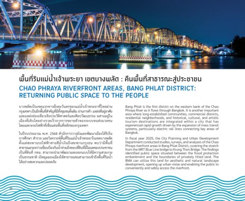
พื่ื�น์ทั่�ริมืแมื่น์�าเจ้าพื่ระยา เขตบัางพื่ลัดำ : คัืน์พื่ื�น์ทั่�สัาธารณะสัู่ปีระช้าช้น์


            CHAO PHRAYA RIVERFRONT AREAS, BANG PHLAT DISTRICT:
            RETURNING PUBLIC SPACE TO THE PEOPLE


            บางพัล้ัดเปี็นเขัต้แรุกัทางฝ่ั � งต้ะวิันต้กัขัองแม่นำาเจั้าพัรุะยาท่�ไหล้ผ่าน  Bang Phlat is the first district on the western bank of the Chao
            กัรุุงเทพัฯ เปี็นอ่กัพั่�นท่�สำาคัญท่�ม่ทั�งชุ้มช้นดั�งเดิม ย่านกัารุค้า แหล้่งท่�อย่่อาศัย   Phraya River as it flows through Bangkok. It is another important
                                                                           area where long-established communities, commercial districts,
            แล้ะแหล้่งท่องเท่�ยวิเช้ิงปีรุะวิัต้ิศาสต้รุ์แล้ะศิล้ปีวิัฒนธิรุรุม ผสานอย่่ใน
                                                                           residential neighborhoods, and historical, cultural, and artistic
            เม่องท่�เต้ิบโต้อย่างรุวิดเรุ็วิจัากักัารุขัยายต้ัวิขัองรุะบบขันส่งมวิล้ช้น  tourism  destinations  are  integrated  within  a  city  that  has
            โดยเฉพัาะรุถ่ไฟื้ฟื้้าท่�เช้่�อมต้่อพั่�นท่�หล้ักัขัองกัรุุงเทพัฯ   experienced rapid growth driven by the expansion of mass transit
                                                                           systems, particularly electric rail lines connecting key areas of
            ในปีีงบปีรุะมาณ์ พั.ศ. 2568 สำานักักัารุวิางผังแล้ะพััฒนาเม่องได้รุิเรุิ�ม  Bangkok.
            กัารุศึกัษา สำารุวิจั แล้ะวิิเครุาะห์พั่�นท่�รุิมแม่นำาเจั้าพัรุะยาในเขัต้บางพัล้ัด  In fiscal year 2025, the City Planning and Urban Development
            ต้ั�งแต้่สะพัานรุถ่ไฟื้ฟื้้าสายส่นำาเงินถ่ึงสะพัานกัรุุงธิน  พับวิ่าม่พั่�นท่�  Department conducted studies, surveys, and analyses of the Chao
                                                                           Phraya riverfront areas in Bang Phlat District, covering the stretch
            สาธิารุณ์ะรุะหวิ่างเขั่�อนปี้องกัันนำาท่วิมถ่ึงขัอบท่�ดินท่�ม่โฉนดขัองปีรุะช้าช้น
                                                                           from the MRT Blue Line bridge to Krung Thon Bridge. The findings
            เปี็นท่�ดินท่� กัทม. สามารุถ่นำามาพััฒนาแล้ะออกัแบบให้ม่ควิามสวิยงาม   identified public space situated between the flood protection
            เปี็นธิรุรุมช้าต้ิ เปีิดมุมมองเม่องให้สาธิารุณ์ช้นสามารุถ่เขั้าถ่ึงพั่�นท่�รุิมนำา  embankment and the boundaries of privately titled land. The
                                                                           BMA can utilize this land for aesthetic and natural landscape
            ได้อย่างสะดวิกัแล้ะปีล้อดภัย
                                                                           development, opening up urban vistas and enabling the public to
                                                                           conveniently and safely access the riverfront.


      58

